

MRP: ₹299
₹261
₹ 38 Off
(Incl. of all taxes)
Qty
Buying in bulk?
In stock
Deliver to
- 7-day returns
- Secure payment
- International shipping
- Carefully packed
Get this at ₹ 248Extra 5% OffAdd items worth ₹999 to the cart & get extra 5% off
Get this at ₹ 235Extra 10% OffAdd items worth ₹1499 to the cart & get extra 10% off
Book Summary
About the Book: India In Triangles: The Incredible Story Of How India Was Mapped
And The Himalayas Measured
As the British East India company established itself in India and gained more
and more territories, it wanted to map the land it was acquiring. But the
current methods lacked precision. So, under the leadership of William Lambton, a
soldier with experience in surveying, a project was launched in the early 19th
century, that proposed to map, initially the then-state of Mysore, and
eventually the entire subcontinent through a series of triangulations. Initially
it was expected to last for just 5 years, but it ended up taking
- ISBN-13
- 9780143468387
- Language
- English
- Binding
- Paper Back
- Publisher
- Puffin
- Publishing Date
- 2025-06
- Product Edition
- 1
- Total Pages
- 184
India In Triangles : The Incredible Story Of How India Was Mapped & The Himalayas Measured
Frequently bought together
 India In Triangles : The Incredible Story Of How India Was Mapped & The Himalayas Measured₹261This item
 Maarikaadu₹63
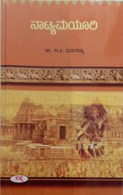 Natyamayuri₹63
Total for 3 items₹387₹439You save ₹52
Product Specifications
Book Summary
About the Book: India In Triangles: The Incredible Story Of How India Was Mapped
And The Himalayas Measured
As the British East India company established itself in India and gained more
and more territories, it wanted to map the land it was acquiring. But the
current methods lacked precision. So, under the leadership of William Lambton, a
soldier with experience in surveying, a project was launched in the early 19th
century, that proposed to map, initially the then-state of Mysore, and
eventually the entire subcontinent through a series of triangulations. Initially
it was expected to last for just 5 years, but it ended up taking
Book Specifications
- ISBN-13
- 9780143468387
- Language
- English
- Binding
- Paper Back
- Publisher
- Puffin
- Publishing Date
- 2025-06
- Product Edition
- 1
- Total Pages
- 184