
MRP: ₹499
₹454
₹ 45 Off
(Incl. of all taxes)
Qty
Buying in bulk?
In stock
Deliver to
- 7-day returns
- Secure payment
- International shipping
- Carefully packed
Get this at ₹ 431Extra 5% OffAdd items worth ₹999 to the cart & get extra 5% off
Get this at ₹ 409Extra 10% OffAdd items worth ₹1499 to the cart & get extra 10% off
Book Summary
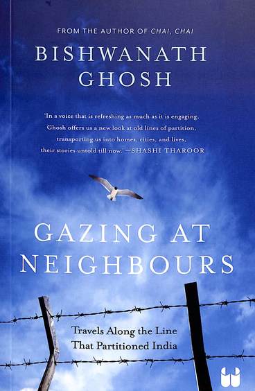
About the Book: Gazing at Neighbours: Travels Along the Line That Partitioned
India
AN INTERESTING TAKE AT THE PARTITION OF THE INDIAN SUBCONTINENT, THIS BOOK LOOKS
AT THE PLACES DOTTING INDIAS BORDERS WITH ITS NEIGHBOURS AND THE PEOPLE WHO LIVE
THERE.
In July 1947, British barrister Cyril Radcliffe was summoned to New Delhi and
given five weeks to draw, on the map of the subcontinent, two zigzagged lines
that would decide the future of one-fifth of the human race.
One line, 553 kilometres long, created the province of West Punjab; the other,
adding up to 4,096 kilometres, carved out a province called East Bengal. Both
territories joined the
- ISBN-13
- 9789360458980
- Language
- English
- Binding
- Paper Back
- Publisher
- Westland Non Fiction
- Publishing Date
- 2024-10-21
- Product Edition
- 1
- Total Pages
- 356
Gazing At Neighbours : Travels Along The Line That Partitioned India
by Bishwanath Ghosh (Author),
Westland Non Fiction (Publisher)
fictionfantasyyoung adultaward winning
Frequently bought together
 Gazing At Neighbours : Travels Along The Line That Partitioned India₹454This item
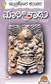 Maarikaadu₹63
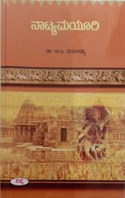 Natyamayuri₹63
Total for 3 items₹580₹639You save ₹59
Product Specifications
Book Summary
About the Book: Gazing at Neighbours: Travels Along the Line That Partitioned
India
AN INTERESTING TAKE AT THE PARTITION OF THE INDIAN SUBCONTINENT, THIS BOOK LOOKS
AT THE PLACES DOTTING INDIAS BORDERS WITH ITS NEIGHBOURS AND THE PEOPLE WHO LIVE
THERE.
In July 1947, British barrister Cyril Radcliffe was summoned to New Delhi and
given five weeks to draw, on the map of the subcontinent, two zigzagged lines
that would decide the future of one-fifth of the human race.
One line, 553 kilometres long, created the province of West Punjab; the other,
adding up to 4,096 kilometres, carved out a province called East Bengal. Both
territories joined the
Book Specifications
- ISBN-13
- 9789360458980
- Language
- English
- Binding
- Paper Back
- Publisher
- Westland Non Fiction
- Publishing Date
- 2024-10-21
- Product Edition
- 1
- Total Pages
- 356